Our message for this post is simple: the Pacific Crest Trail section through Washington is special. At least we think so. After five years of living in this state, there’s no place we’d rather be… except maybe somewhere warm and sunny during the thick of winter, but that’s beside the point. As soon as our feet crossed the Bridge of the Gods on the OR/WA border, we felt at home and excited to see new areas of the Cascade range.


Photos by Amos Almy
Goat Rocks Wilderness
Even with our love for Washington in mind, we’re still able to admit that things start out a little underwhelming considering the hype of this section. But you’ve got to have faith! As you climb out of the Columbia River Gorge and towards Mount Adams, you’re mostly in the heart of a forest. Everything is green and lush. Streams are abundant but the views are limited. That is, until the trail takes you around the base of Mt. Adams, where you catch frequent glimpses of the 12,280 foot volcano. It’s easy to then think, “Huh, the guide books weren’t kidding.” Best of all, you’re just getting started.
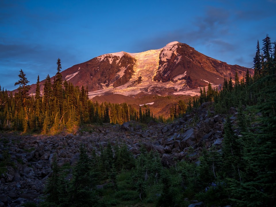
Photo by Amos Almy
Once Mt. Adams is in the rearview and you continue north, the next big landmark is Goat Rocks Wilderness. If you ask a PCT Thru-hiker what their favorite section is, 9 times out of 10 (maybe more! This is a made up figure after all) they will chant Goat Rocks – Goat ROCKS! Rather than over explain the spectacular nature of this place, I will shut up and let the pictures say it all.


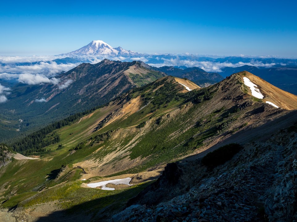
This stretch has some of the best ridge walking on the entire PCT. Three volcanoes can be seen from one place, two of them looking equally massive from your vantage. Doesn’t this just make you want to dance?!
Highways and Ski Resorts
Washington is relatively remote. For nearly the whole state, you walk through land designated as either a National Forest or National Park. 319 of the 500 miles of the PCT in WA goes through federally designated Wilderness (yes, capital ‘W’ wilderness. I have a whole other blog post discussing that concept and its nuance here and here). Instead of hiking near towns, the only time the trail pops you out of the mountains is to cross a major highway, which usually has a ski resort and convience store.
Similar to Oregon, we figured out our resupply strategy a little bit ahead of time, and sent ourselves a few boxes (which we made on trail, not months before our thru-hike). The hitches are long and can be time-consuming. Though, each highway does have a nearby town with hiker amenities. One place to check out for sure is the Aardvark Express at Snoqualmie Pass; the Hurry Curry was phenomenal and hikers receive a free beer!
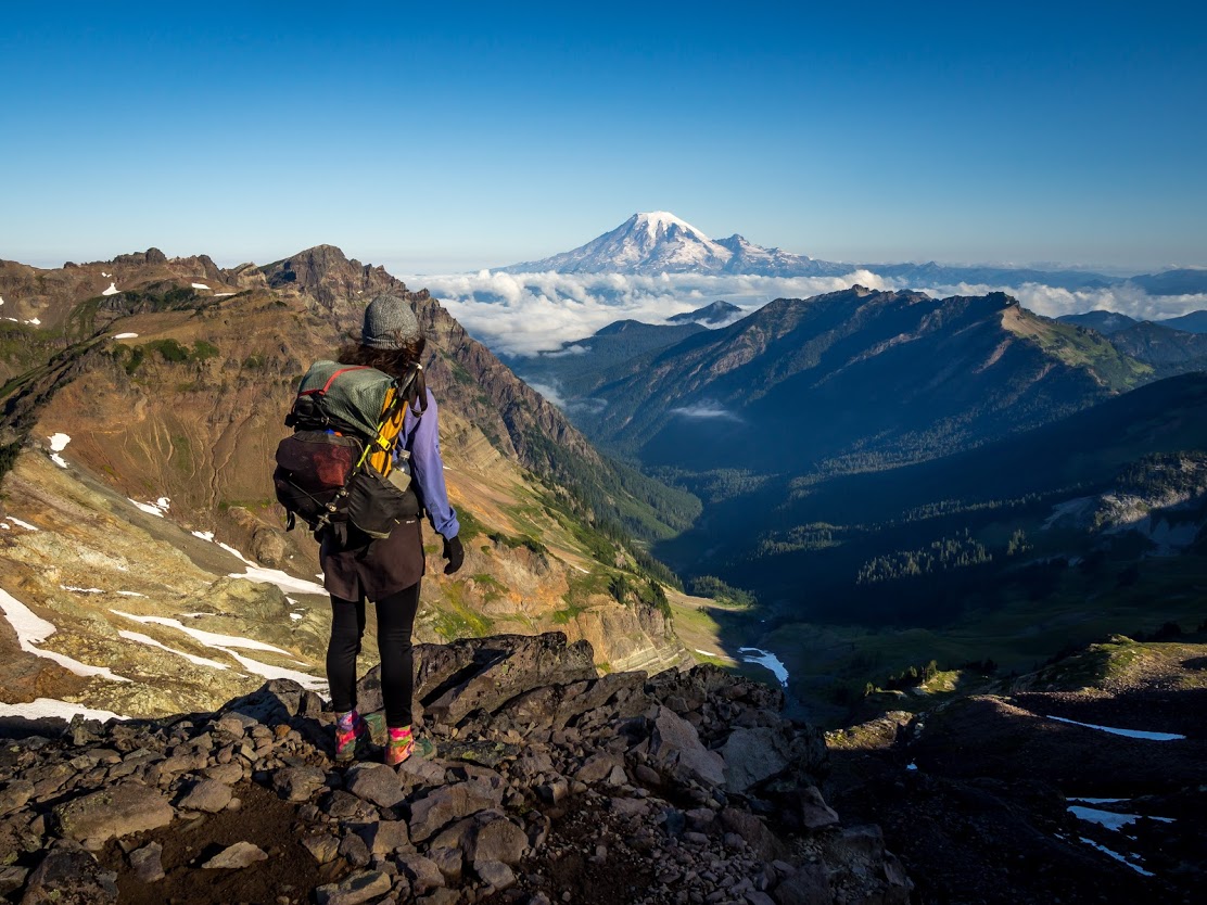
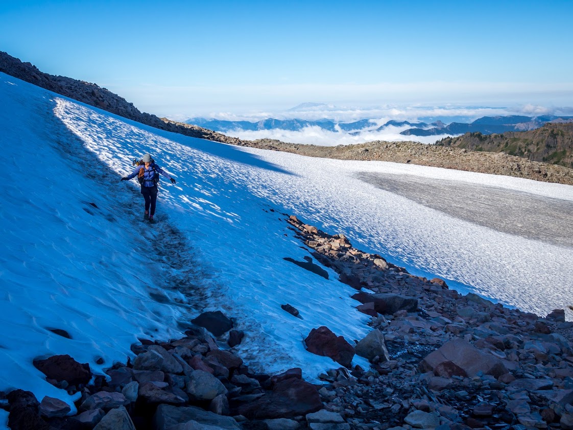
Glacier Peak Wilderness
If you ask Tuna Butter what his favorite section of the whole PCT is he will say Glacier Peak Wilderness without blinking an eye. From when you leave Stevens Pass – HWY 2 – all the way to Canada, there is no cell phone service. At least we didn’t have any service with Verizon, which is the most reliable carrier on trail. In Stehekin you might be lucky enough to score some delicious wifi, but don’t plan on downloading the newest season of Stranger Things. That wifi is known to go down or be very sloooow. This whole, no-cell-phone-service experience helps to put that remote feeling of this section into perspective. You feel far away from roads and the business of a city.

Photo by Amos Almy
This is the time to truly take in all that is around you. As you feel strong and can easily hike 25 miles a day, make sure to enjoy the beauty and relish that fact that you are a part of it, in the heart of something that is wild.
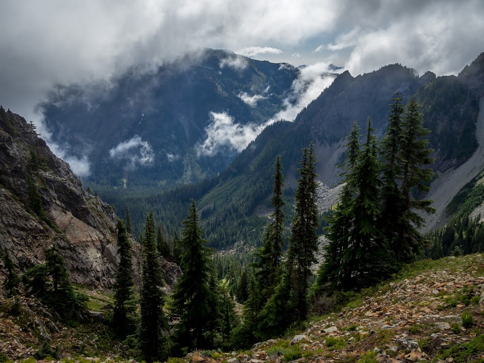
Photo by Amos Almy
Swimming
We were tired, hungry, and in low spirits. We might have even been arguing about something? But then the trail turned a corner and our eyes caught the turquoise shimmer of an alpine lake. Almost immediately, our human troubles no longer mattered. By the edge of the lake, we threw off our shoes and socks and clothes, too, and splashed into the frigid waters. It was invigorating, even cleansing (literally – I mean, imagine the sweat and caked on dirt of a thru-hiker).

Photo by Amos Almy
This was our first dip in an alpine lake on trail. And we know, that seems ridiculous considering all the beautiful bodies of water the trail takes you by! Don’t be like us! Put your backpack down, throw away your schedule, and take the time to swim in as many lakes as you want. The water may be cold, but you’re probably gross. Just do it.
Stehekin
We were shocked to learn that the little mountain town of Stehekin sometimes has a bad rap among thru-hikers. These boisterous hikers on Guthooks and other social media platforms complain about the slow pace of the town and its lack of accommodations, specifically its prices for certain luxuries. Many have gotten into their own routine of cranking out miles and expect towns to serve as a quick resupply stop, or a place where they can drink lots of beer at a brewery and eat lots of hot meals. In our humble opinion, Stehekin is worth the break from whatever routine you have or haven’t established.

Photo by Amos Almy
Stehekin is tucked away in the North Cascades at the northern end of Lake Chelan. It is rich with cultural significance and history. You can only walk, boat, or fly to get there. Chat up a local and it is almost guaranteed that they will have an interesting story. It feels like a slice of Alaska in the lower 48. There is a bus that takes people to and from the trailheads, which are plentiful.

Photo by Amos Almy
However, we were able to hitchhike around with no problems. The first car that saw us picked us up (all three times) and one even offered us beer and beef jerky as we drove down the bumpy dirt road.
Also, the Stehekin Bakery will blow your holey socks right off! They have amazing cinnamon rolls and other baked goods along with normal cafe items like sandwiches and hot beverages. There is also a “day old” fridge and counter and wow, did we go crazy stocking up… I think I ate cold, cheap pizza slices from the bakery three days in a row (we most definitely hiked out of there with goodies!).
Another spot we enjoyed was the beloved Stehekin Garden, where we purchased and indulged in our fix of fresh fruit and vegetables for the month. And if you can make it to the Orchard, you are free to enjoy fresh apples right off the trees! This place is a freaking destination vacation.
Canadian Border
After you leave Stehekin you still have some amazing views ahead of you. Cross your fingers and hope for Trail Magic as you approach Hart’s Pass. On weekends, it is a busy trailhead and scoring some food has a high probability. If you are unlike us and you don’t have a section to go back and complete, this is it! The last stretch of trail after the 2570 miles you have already hiked. Savor it. Take in the views. Enjoy the time with trail friends. Dwell on the memories you have made. You will soon begin the gradual descent back into the green tunnel and walk to the border of the United States and Canada.

For us, it was a bit anticlimactic reaching the monument. This was a spot we had dreamed of when we began our hike, but now it was just the end of another section. We still had 412 miles in the Sierra Mountain Range of California. Either way, we enjoyed the iconic monument, taking a step in and out of Canada, and tried to maintain our hype to finish the entire trail. And spoiler, we did! Stay tuned for our post next week on the Sierra (the last one in this summary series!).
~ Tuna Butter and Calypso

❤ you all are so great! love your enthusiasm for the nature! hope you got to catch up on Stranger Things eventually.