In 2019, there were hella high levels of snow in the Sierra Mountain Range. The snowpack was at 176%, which left us Pacific Crest Trail thru-hikers with a difficult decision to make: do we try to hike through the Sierra or figure out another option? Eventually, Tuna Butter and I settled on skipping 400 miles north into Northern California. This blog post picks up after that skip. You can learn more about what went into that decision-making process in our previous post “To Hike, Flip, Skip or Quit in the Snow Sierra?“
We jumped north into Truckee, California and set off on the PCT from Donner Pass (Mile 1157). We made the skip with a trail friend named Fish Addict. After a bus and a hitch, we set off in the early evening of the Summer Solstice.

Day 1
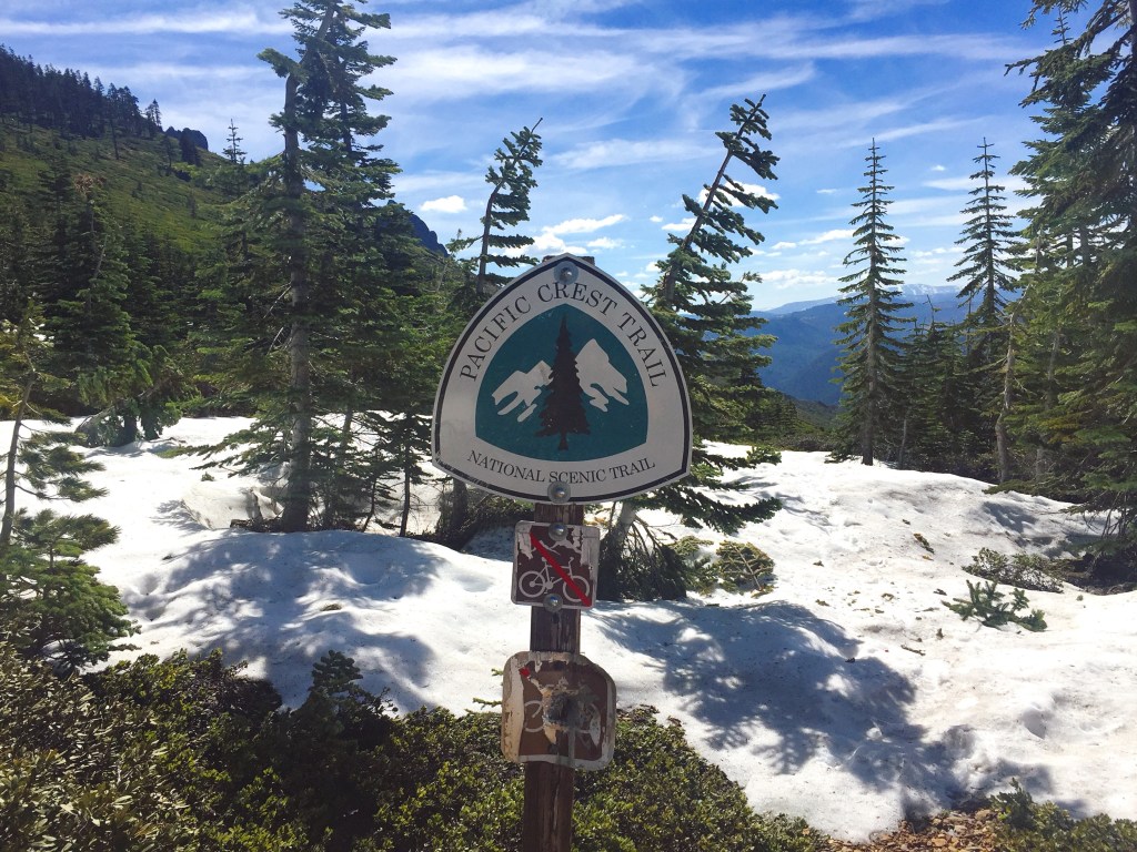
It was inevitable that we’d hit snow. We were hiking this section earlier in the season than most thru-hikers. Because of this, we came prepared with our ice axes and microspikes. On a normal year, these items would be unnecessary for this section, but we were glad to have them.
Our original plan for day one was to stay at a hut on trail – one of the few rare ones along the entire PCT. We left Donner Pass separately from Fish Addict, fully intending to meet up that night. Right away, we were walking on several feet of snow. It was a pain to navigate through the thick forest with no trail markers. The GPS on our phones came in handy, as well as our own intuition. Surprisingly, we crossed paths with a SOBO (southbounder) who informed us that the Sierra Club had rented out the hut for the night and were not letting thru-hikers stay there, which was a major disappointment.
Instead, we found a spot to sleep on an exposed ridge. It was super windy but miraculously snow free. We texted Fish Addict with a plan to meet up the next day. Tuna Butter hardly slept that night and kept worrying that the wind would rip apart our tent. Fortunately, that didn’t happen (thanks Big Agnes!).

In the morning we passed the hut full of Sierra Clubbers, all warm and snuggly by their wood stove. I, Calypso, tried not to feel envious as I wore all of my warm layers to hike.
Navigation through the snow was mind boggling slow. We had to figure out our groove of hiking with no trail to follow. Instead of trying to follow the red line of “the trail” on our GPS perfectly, we’d look at the map to get a general sense of direction and what the terrain is like. With that information, we’d figure out the best way forward. Sun cups were plentiful, and there were several rolling snow hills to muscle through. This type of travel is mentally and physically fatiguing. You have to be on alert about where you’re hiking 100% of the time. We’d heard stories of people getting lost in the snow on the PCT and didn’t want to succumb to that same fate.

That night we found a bare dirt road to pitch our tent on. There, we settled in alongside shotgun shells and unofficial fire pits that you know locals use for their ragers. With still no word from Fish Addict, we went to bed hoping that no dudes would drive up in the middle of the night to throw a backwoods party.
Day 3 we made it into Sierra City on 16 miles of almost snow-free trail! How glorious it was, even though Calypso almost stepped on a rattlesnake in the middle of the trail! Our day ended with grabbing grub from the general store, being offered free ice cream(!), and hanging around town with some grumpy flip-floppers. They were so tired of the snow. Finally, we received a text from Fish Addict… He’d turned around and hiked south on Day 2 hoping to cross paths with us. Since we were all following our own paths through the snow, we never ran into him. Now he was on his way home. Well damn!
The End of the Snow?
In late June to July, Northern California had more snow than we’d anticipated. Our biggest challenge of that section was McRae Ridge. Climbing up thru the snow wasn’t too bad, even though we had to scramble up – hand over hand – literal boulders to get to the top. Traveling down, however, was major sketch! It didn’t make sense to follow the trail through the steep snow sections with horrible runout. Instead, we cut straight down the 65-degree slope, bushwhacking through trees while holding onto their trunks for balance. Eventually we realized we’d get cliffed out if we continued with this strategy. With our ice axes in hand, we carefully kicked steps into the snow. Over several hours, we worked our way down the mountain, switchbacking through the snow to avoid a gnarly tumble into the valley below.
Our concentration levels were at an all-time high during the descent. There’s simply no extra room in your brain for thoughts other than your calculation of your next foot placement. Every step is intentional. And this is mentally draining. If you end up in this section before things melt out, be aware of the conditions of McRae Ridge.
Entering the Cascades

Around Belden, we noticed that the rocks around us were changing. Some were the familiar grey granite of the Sierra, and some were more reddish in color from the oxidation of iron. The geology signified something that was quite exciting – we were leaving the Sierra Mountain Range behind and entering our beloved Cascades!
In this tiny town located at the bottom of a river valley, we scarfed down the double cheeseburgers we’d been dreaming about for days, along with fries and a blackberry milkshake. After resupplying, we stayed the night at a lovely trail angel’s house, where Tuna Butter ate an entire pint of Ben and Jerry’s ice cream before bed. Hiker hunger was official. We began to carry a jar of Nutella to supplement our meals with more calories.
A NorCal State of Mind

The Northern California section is infamous for its long uphill and long downhills (12-24 miles) in and out of towns. Leaving a town often involved a sweltering, all-uphill stretch in the full sun, with – our favorite – rattlesnakes. At this point in the PCT journey, many hikers begin to test what their bodies are capable of. We did this by hiking our first 30-mile days. In general, we ramped up our daily mileage goals into the 20s. There was little time to lollygag if we were to make it to Canada with enough warm weather left in the season for the Sierra. It would be ironic to skip the Sierra section to just end back up in the snow (which may or may not have happened anyway…)
From One Volcano to the Next
The town of Chester is cool. A parkie friend of ours from Alaska hosted us for two nights at Lassen Volcanic National Park. Yep, being Park Rangers comes with its perks. She stuffed our scrawny bodies full of good food, provided all the amenities to get clean, a REAL bed to sleep in, and lots of smiles. I, Calypso, was going through a rough time with sad family news, and so her kindness meant a lot.

Many thru-hikers throw shade at NorCal. This stretch is often referred to as the “California Blues.” After spending month after month of hiking over half the trail without a single state border, hikers begin to crave change. They want some sort of marker to help them feel like they’re getting somewhere. We didn’t feel this much, having just skipped 400 miles. Though I was preoccupied with what was happening back in “real life,” feeling my own sense of blues.
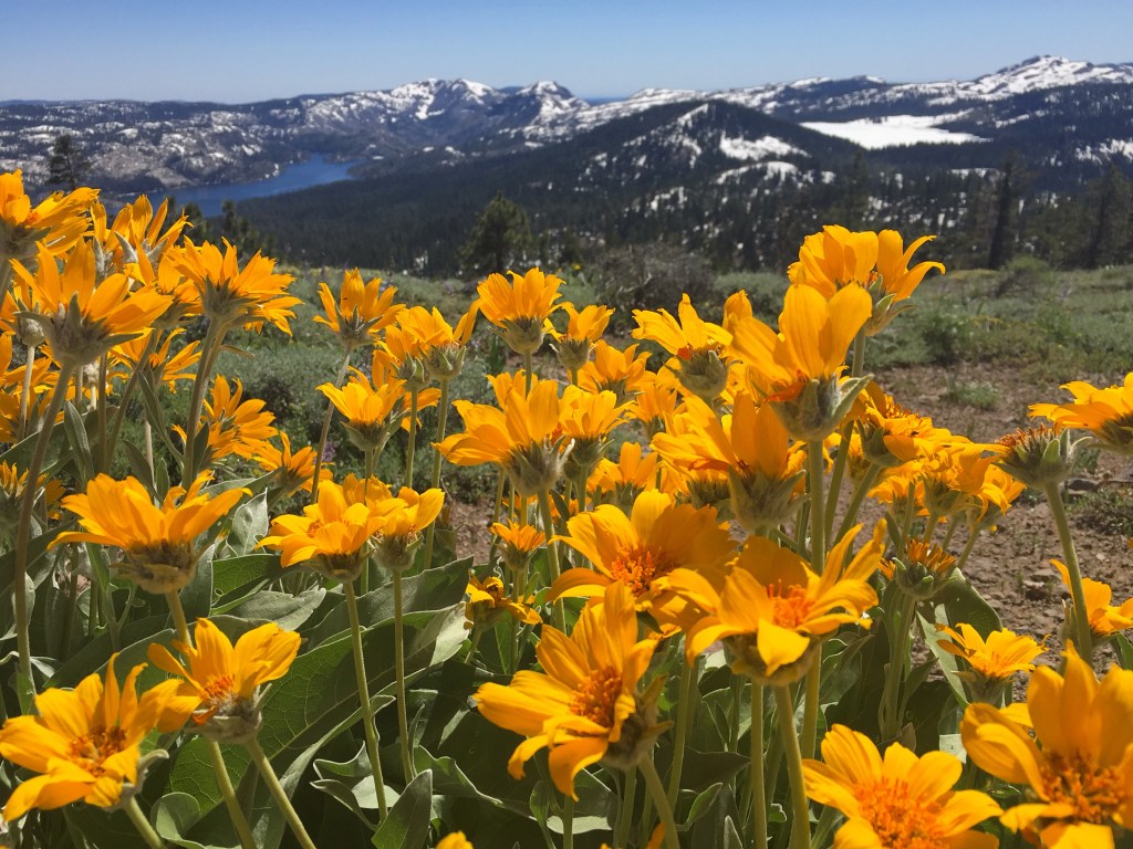
The day we hiked Hat Creek Rim, my mother passed away from cancer. I found out the sad news as we trudged through a very dry section, lugging extra water in my pack. I found out while facing one of our first views of Mt Shasta. Though my heart was heavy, we had to continue onwards to camp, inching closer to our next water source. That day we were surrounded by wildflowers. With dust between every toe, we watched paragliders drift overhead, held up in the air by an invisible force. At camp, the sunset lit up the sky. It was a day of high emotion, though surrounded by beauty nonetheless.
The Burney Boo-Boo
Burney, California is an interesting little community. We hitched into town to resupply and to send our ice axes home. The Word of Life Church opens their gymnasium building up to thru-hikers. We were able to use the showers, borrow loaners clothes, and cook food in the kitchen. We made some yummy, much needed meals in that house, which was cheaper than eating at restaurants. I say meals, plural, because our intended “nearo” day in town quickly morphed into three and a half “zero” days when I accidentally cut a HUGE gash out of the bottom of my foot. I walked around a corner and hit a dolly (hand truck) with my foot and sliced it open. It happened while I was grieving the loss of my mother inside an empty church building. (Don’t walk barefoot folks!) Many tears were shed onto the carpeted gymnasium floor. Sometimes injuries can serve as a sign to slow down. The collision between the metal dolly and my foot was that for me; it made us stay in town, feed our hungry bodies, and take time to rest, heal, and recover.
Even if that meant we now had to hike extra long days to make it to Canada in time.
Onwards to Oregon
NorCal continued with its big ups and downs. We followed the never-ending switchbacks of the dirt path. We enjoyed the Trinity Alps Wilderness, despite its thunderstorms, and the Marble Mountains.


These two areas are often underrated, yet possess their own unique beauty. The days were hot but manageable, water became plentiful, and we kept ticking off the miles. With a daily average of 20 miles, we soon approached Oregon. Though we’d not yet completed 50% of the PCT, our trail legs were starting to form. The reportedly flat and easy section of OR made us hungry for big miles.
And that’s all we have to say about life in NorCal! Until next time.
~ Tuna Butter and Calypso
